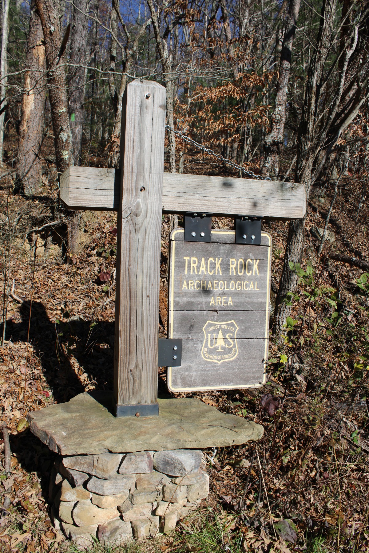
Visitors to the Chattahoochee-Oconee National Forests near Blairsville, Georgia, have a unique opportunity to view a large collection of petroglyphs.
The first question a reader may have is, just what a petroglyph is. According to the National Park Service “Petroglyphs are rock carvings (rock paintings are called pictographs) made by pecking directly on the rock surface using a stone chisel and a hammerstone.”
Track Rock Gap is located between Thunderstruck Mountain and Buzzard Roost Ridge near the
town of Blairsville in Union County, Georgia. Here, more than 1,000 years ago, Creek and
Cherokee peoples created the soapstone carvings we now enjoy today.
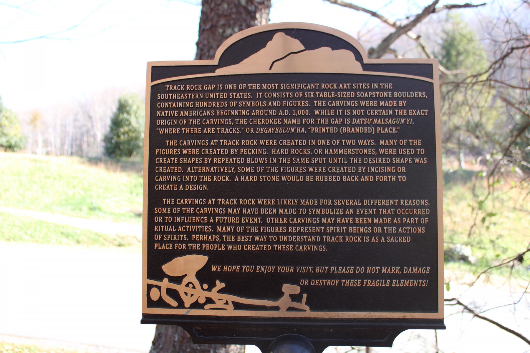
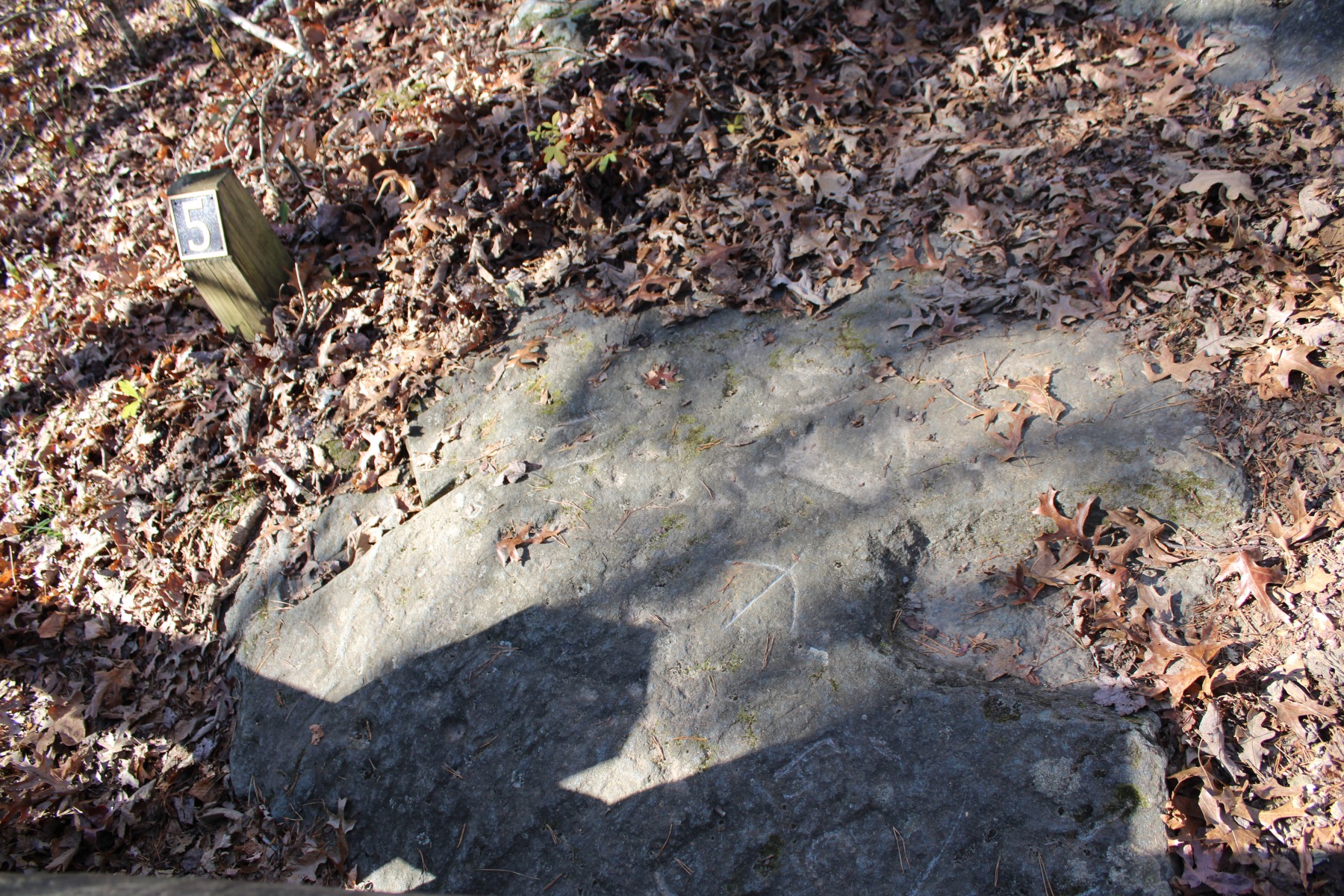
Considered one of the most significant rock art sites in the Southeastern United States, Track
Rock features a diverse grouping of more than 100 figures.
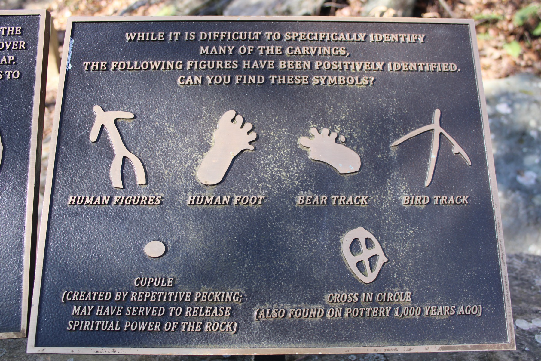
Archaeologists do not believe Track Rock to have had a singular purpose or to have been carved in a singular period; rather, the carvings were made over time and for differing reasons. Some of them may symbolize or commemorate a particular event that happened. Others may have to do with rituals and ceremonies. As the National Park Service states
Furthermore, the setting of Track Rock in a gap places it at a threshold. In numerous Cherokee stories, footprints and tracks signify an in-between or transitional state or condition. More specifically, rocks with footprints and tracks signified the area of transition, a doorway or threshold, into the domain of dangerous spirit beings.
Depictions of footprints and tracks are not only physical testimony that spirit beings were there some time in the past, but that they could still be lingering somewhere close-by in the present, and that they may return unexpectedly at any time in the future.
You can easily visit this amazing archaeological site. There is no entry or parking fee charged.
You can reach Track Rock Gap by taking US 129 to Blairsville, then US 76 east about five
miles. At the signs for Track Rock Gap Road, turn right for about two miles to the gap. Their
location in the gap makes stopping beside the boulders very dangerous.
Drive on through the gap, noting the Track Rocks on the right, and look for the small parking lot
on your right. Park there and take the trail back to the gap, safely from traffic. The trail is not
long or strenuous but it is through a wooded area so proper footwear is suggested. The path can
be slippery depending upon weather conditions.
The NPS suggests visiting when sunlight is at a low angle. Consider visiting either early morning or late in the day. Brighter sunlight makes viewing the petroglyphs more difficult. If you click the link below to learn more about the site there are convenient fact and description sheets available to help you navigate the site.
Remember, leave nothing but footprints and take nothing but photos. Let’s make sure this sacred site is available for the next thousand years.
To learn more about the petroglyphs visit the forest service site here.
Learn more about the Archaeological Resources Protection Act (ARPA) by visiting the National Park Service page here.
You can learn more on the subject by reading the account “An Archaeological and
Ethnohistorical Appraisal of a Piled Stone feature Complex in the Mountains of North Georgia”
published in the journal Early Georgia (Vol. 38, No. 1, p. 29-50) in 2010 by archaeologists
Johannes Loubser and Douglas Frink. Check with your local librarian to see if any of their
databases carry this journal.
Are you interested in hiking in the Chattahoochee National Forest? This map pack from National Geographic is a must have.
National Geographic’s Chattahoochee Bundle Pack combines two Trails Illustrated titles for Chattahoochee National Forest. Located just north of Atlanta, the Chattahoochee National Forest contains the southern terminus of the Appalachian Trail along with an abundance of recreational opportunities for outdoor enthusiasts of all interests. The maps’ highlights are: Southern Terminus of the Appalachian Trail, Russell-Brasstown Scenic Byway, Cohutta, Raven Cliffs and Rich Mountain Wilderness Areas, White Rock Scenic Area, Brasstown, Ellicot Rock, Southern Nantahala, Tray Mountain, Raven Cliffs Wilderness Areas, and Chattooga Wild and Scenic River.
Click the photo or this link for more information on purchasing the map.
