We will start June 2023 off with a couple of new additions to the library. Both of these books were purchased by me and are not provided by a publisher or distributor.
Enter a grave new world of fascination and delight as award-winning writer Peter Ross uncovers the stories and glories of graveyards. Who are London’s outcast dead and why is David Bowie their guardian angel? What is the remarkable truth about Phoebe Hessel, who disguised herself as a man to fight alongside her sweetheart, and went on to live in the reigns of five monarchs? Why is a Bristol cemetery the perfect wedding venue for goths?
All of these sorrowful mysteries – and many more – are answered in A Tomb with A View, a book for anyone who has ever wandered through a field of crooked headstones and wondered about the lives and deaths of those who lie beneath.
So push open the rusting gate, push back the ivy, and take a look inside.
Modern historians have consistently treated Florida as a military backwater. Despite that assessment, Rebel guerrillas blocked repeated Union attempts to establish a stronghold in the Florida’s interior. After the “abandonment” of Florida by the Confederate government, in early 1862, Gov. John Milton organized guerrilla units to protect the state’s citizens. These irregular companies kept Union forces largely confined to a few coastal outposts (St. Augustine, Fernandina, and Ft. Myers), though the state’s citizens suffered greatly from the depredations of Unionist units.
After the Federals capture of Vicksburg, the South’s only significant source of beef were the vast herds in Florida. It fell to the state’s Rebel partisans to protect the state’s interior, thereby keeping open routes for the delivery of longhorns to the South’s major armies. Skirmishes and battles raged throughout Florida, but the flow of beef cattle halted only after Appomattox.
I do receive a very generous “thank you” in the acknowledgements but those of you who know me understand I have purchased this book for my Florida Civil War library without hesitation. Zack is an excellent historian and this is a book covering an important part of the Florida Civil War history.
This post may contain affiliate links. If you click these links and make a purchase, I may receive a small commission. This commission does not affect any price that you pay. All views and opinions provided are my own and are never influenced by affiliate programs or sponsors providing products.
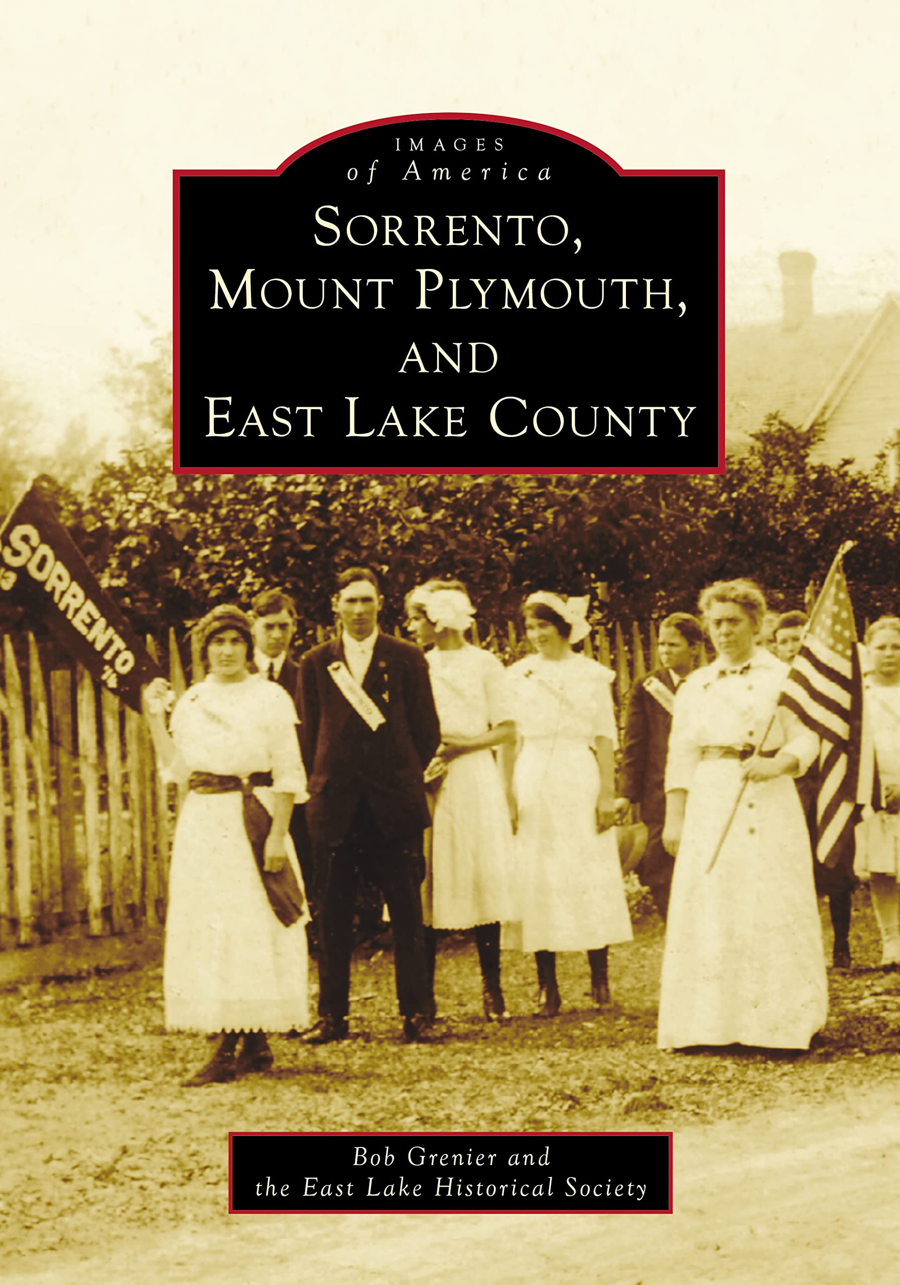
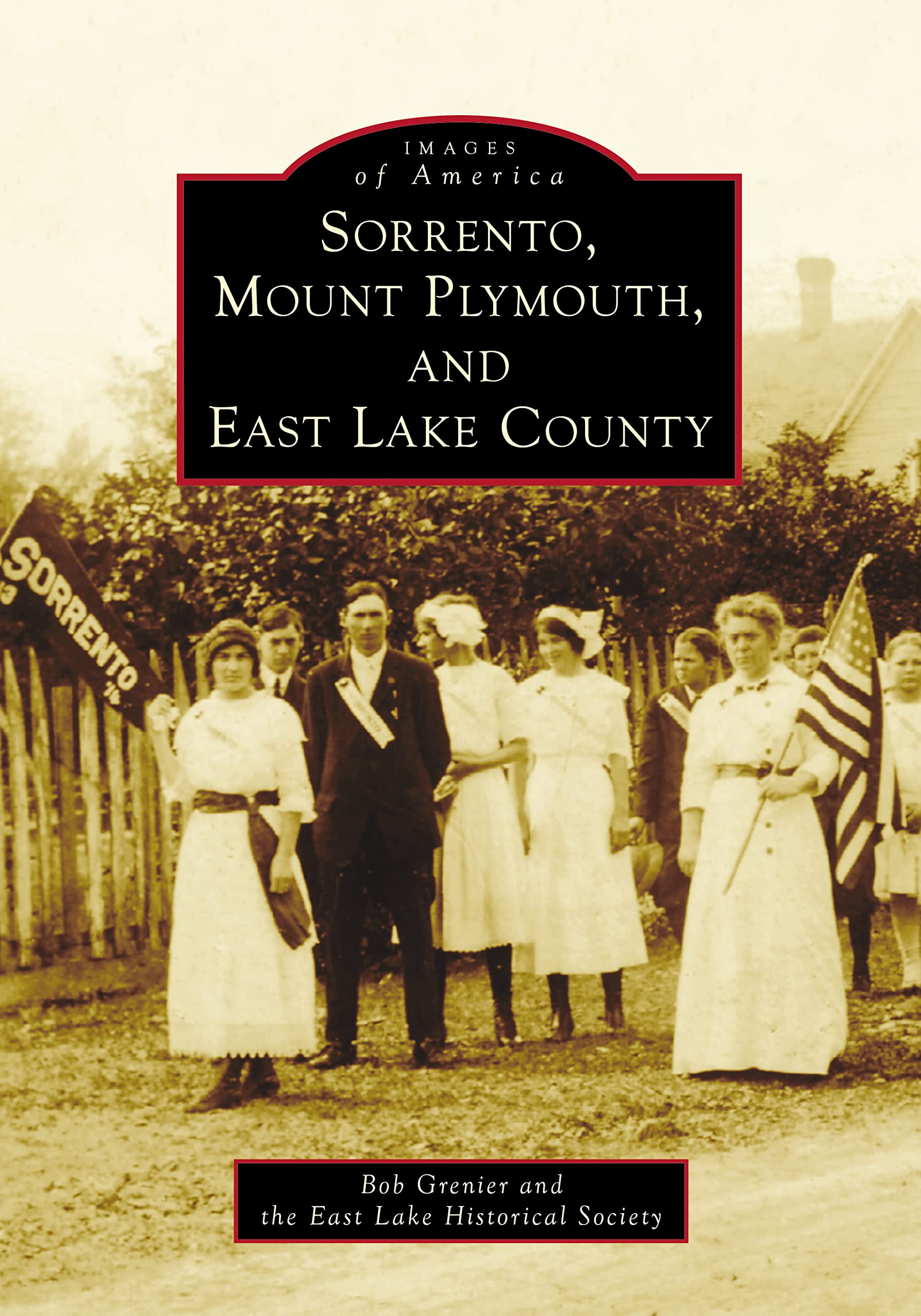
Thank you for taking time to read my book review of Sorrento, Mount Plymouth, and East Lake County written by Bob Grenier and published by Arcadia Publishing. This book makes a solid contribution to Lake County and Florida history.
Lake County, Florida is a rapidly growing area in Central Florida with Clermont being a bedroom community for Orlando, but also with proximity to Tampa. With a population of 297,000 in 2010, the county now boasts a staggering 410,000 persons just over a decade later, a growth of over 71%. When a county grows this fast, how do long term residents keep up with their history? As the number of transplants, often with no roots or desire to put down real roots, grows, what can be done to preserve the legacies of those who have built these now booming areas?
While the Clermont and west Lake County areas are not covered in this book, Bob Grenier and the East Lake Historical Society have provided a fine volume that will go far in making sure the names, deeds, and legacies of those from the East Lake County area will not be forgotten.
Mr. Grenier is well qualified to have gathered photos and penned a volume such as this. He is the author of several other Images of America volumes including works on Tavares, and Leesburg, along with books on Central Florida veterans from the Civil War, and World War II. Bob is a well known speaker throughout the region and has presented his work at many museums and historical societies. Mr. Grenier exhibits a sincere passion for his subjects both in writing and in his presentations. If you get a chance to hear him present, I recommend attending.
Bob has been a resident of Lake County, Florida since 1985 when he moved south from Illinois. Originally settling in Mount Plymouth, Bob was familiar with the area. When the East Lake Historical Society was founded he was able to reconnect with the area. He has put his experience as an author, public servant, and museum director to work in compiling this fascinating volume.
East Lake County is often overlooked in comparison to the cities in the mid and western parts of the county. As mentioned, Clermont is rapidly growing, having grown to almost 50,000 residents on its own, up from 28,000 in 2010. Cities such as Mount Dora, Leesburg, and Tavares, the county seat, often garner the most attention as might be expected. What of the small communities of east Lake County? They continue to be home to dedicated residents, proud of their local communities.
Mr. Grenier starts the book off with an interesting, but brief, two page introduction to his subject. Here, he quickly covers his subject matter. Here we learn of the Sorrento Immigration Service and how northern migrants helped develop the town in the post Civil War years. Special mention is given to Major Alexander St. Clair-Abrams, a man Mr. Grenier is well associated with, having expertly put together a volume of Abrams writings.
Mount Plymouth is described by Mr. Grenier as “a Currier and Ives painting come to life” (page 8). Here we learn of the Mount Plymouth Corporation and the plans of powerful men such as real estate developer H. Carl Dann, John Pirie of Carson Pirie Scott and Company fame, and baseball legend Connie Mack. Their dream was to develop a 5,000 acre parcel into a winter resort, reminiscent of the Scottish countryside.
The small community of Cassia on State Road 44, only about ten minutes from the Lake/Volusia County line is home to the annual Cassia Day, an event filled with food, games, music, and community, to help celebrate the heritage of this area which can trace its first settlers to the 1850s. I have often passed through Cassia on State Road 44 and never given it a moments consideration. That oversight needs to be rectified.
Readers are invited to find more of my book reviews from Arcadia Publishing. Please use this link.
The meat of the book is of course the photos, and this book is packed with them, including well over 200, spanning from the earliest days of these communities to more modern times helping show how these towns have evolved but still retain their sense of community. As can be expected, some of the image quality is better than others. The reproductions can only do so much based upon the source material. Overall though, I think you will be impressed.
Here we meet early settlers, families that often had to struggle to make their lives work. We also meet men like Sam Stoltz, a self taught architect from Chicago. Mr. Stoltz created Tudor style homes in Mount Plymouth. We get to see photos of some of these “Plymouthonians” in the book. (page 64)
We are treated to beauty queens (page 58), Civil War soldiers (page 86), Camp Boggy Creek (page 97), and a gentleman by the name of “Possum Slim” and his amazing story (page 51). My favorite images may be of the Sorrento Baseball Club dating to around the turn of the twentieth century (page 17).
For those interested in Lake County history this is a must have. Readers interested in Florida history and the development and evolution of small Florida towns should consider adding this title to their library. Well written, with a diverse subject matter included, Mr. Grenier and the East Lake Historical Society have done a fine job in showcasing this unique part of Florida.
This post may contain affiliate links. If you click these links and make a purchase, I may receive a small commission. This commission does not affect any price that you pay. All views and opinions provided are my own and are never influenced by affiliate programs or sponsors providing products.
For full disclosure, Bob is a friend of mine and I have had the pleasure of reading his work in the past and also seeing him as a presenter. He puts his heart into his work and his passion shows through. I have no doubt this book will be the same and it has move to the top of my to-be-read pile.
From the publisher:
The town of Sorrento in East Lake County, named for the picturesque coastal town in southwestern Italy famous for its abundance of orange and lemon groves, was first settled in 1875 by the William Butts family. They were soon followed by the Kerr, Reeve, and Miner families.
That same year, five bachelors from Ohio arrived–among them being Albert Matlack and Ed Averill, who were instrumental in the development of this new community. Matlack, who opened the first mercantile business with Charles Adams, surveyed, charted, and mapped the new town, while Averill built the first tourist hotel, called the Averill House.
By 1882, many motivated new settlers arrived, which prompted swift growth in this scenic village carved from the Florida wilderness. A church, schoolhouse, drugstore, post office, packinghouses, dairy farms, cattle and horse ranches, and brick, lumber, and turpentine mills, framed by peach orchards and endless rows of orange groves, established Sorrento as a flourishing destination.
Mount Plymouth, distinct with its famed Storybook homes of renowned architect Sam Stoltz and the celebrity winter retreat of the Mount Plymouth Hotel, compliment the East Lake County landscape.
To find Bob’s other books, please use this LINK. He has several titles that will be of interest to those studying Lake County, FL history and a couple of excellent books in the Images of America series dealing with Central Florida WWII and Civil War veterans.
This post may contain affiliate links. If you click these links and make a purchase, I may receive a small commission. This commission does not affect any price that you pay. All views and opinions provided are my own and are never influenced by affiliate programs or sponsors providing products.
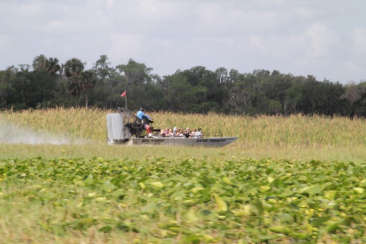
If you’re looking for an exhilarating way to get up close and personal with Florida’s diverse wildlife, then Boggy Creek Airboat Adventures one-hour airboat tour is a must-do activity on your list.
Below is my book review of Sharpsburg Images of America where authors Vernell and Tim Doyle strive to show the history of the town other than just the Battle of Antietam.
The town of Sharpsburg, MD is a small community located in Washington County, near the border with Pennsylvania and is home to less than 1,000 residents. Sharpsburg was founded in 1763 and incorporated in 1832. The town is best known for the Civil War battle that occurred in September 1862, better known as the Battle of Antietam. There, more than 130,000 combined Union and Confederate men fought it out to what many consider a stalemate that was ultimately a Union victory as Robert E. Lee and Confederate troops retreated south across the Potomac. The casualty toll from the battle was horrific, more than 22,000 dead, wounded, missing, or taken prisoner. More than 3,600 men would be killed. Today, many of the Union dead from this battle are interred at Antietam National Cemetery. Abraham Lincoln used the seeming Union victory as his opportunity to announce the Emancipation Proclamation.
In their Images of America series book, authors Vernell and Tim Doyle, a retired teacher and retired journalist respectively, try to remind us that the community of Sharpsburg is much more than the Battle of Antietam. If you are unfamiliar with the series, authors pull together around 150 images around their subject, providing concise captions to help further their story. In five chapters, the Doyles lay out a history of Sharpsburg where the battle plays only a partial role. Only one chapter is tied directly to the September 1862 fight. In fact, they make their point right from the start. The cover photo of the book features the J. Hammond General Merchandise store and was taken in August 1932.
In their five chapters, the Doyle’s outline the history of a small Maryland community, from its earliest days of small farms and the Chesapeake & Ohio Canal through more modern days using a mix of photographs from their own collection, locals, the National Park Service, and other sources. This diversity of sources becomes one of the strengths of the book rather than relying on images from the Library of Congress that have been recycled over and over. Sure, there are quite a few images from the National Park Service and the Washington County Historical Society, but I bet the vast majority of these photos will be new to readers.
Chapters include the Town, the People, the Battlefield, the Canal, and the Area. In less than 130 pages, the battlefield is only given fifteen direct pages. I don’t find that to be a problem and neither should other readers, even those interested primarily in the Civil War. Even with the destructive impact that the Battle of Antietam had, it is important to realize the community was there before and still remains there today.
Interesting photos to me included that of Nancy Campbell (page 61) a freed slave, who at the time was described at a woman of “extraordinary good conduct and good character as proven to us by the testimony of William Rulett.” The chapter dealing with the C&O Canal showed just how important this was in diversifying job opportunities at the time. Other photos show just how similar our worlds are. Smiling groups of school children could be from most any community. Church groups and choirs could be interchangeable with towns in the south or the west. Local baseball teams might play on fields across the country if not for SHARPSBURG being emblazoned on their uniforms.
Each image is accompanied by a few lines of text, explaining to readers/viewers what they are seeing. The authors do not have a lot of space available for these captions and many are quite short thought others do go into more detail. These are easy to read and make each chapter easily digestible at a sitting.
And yet, while the Doyle’s do an admirable job of trying to keep the focus off the battle, one can’t help but return to September 1862. Period prints, with images of the Dunker Church, and armed men in rows ready for battle mix with later views of the Bloody Lane and Burnside Bridge. While president Franklin Roosevelt pays his respects during the 1937, 75th anniversary commemoration, a Lions Club meets on the battlefield for a group photo with a piece of artillery in 1962.
Can Sharpsburg ever shed its Civil War association? No, and the question really should be, would it want to.
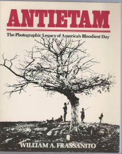
For those looking for insights into the Battle or a heavily Battle focused book this is not for you. If battle images are what you seek, I strongly recommend Antietam: The Photographic Legacy of America’s Bloodiest Day.For those interested in the community, and perhaps what the real Sharpsburg has been in addition to a bloody battlefield, this book is recommended.
If you would like to read more of my book reviews, please use this link.
This post may contain affiliate links. If you click these links and make a purchase, I may receive a small commission. This commission does not affect any price that you pay. Affiliate programs or sponsors providing products do not impact the views and opinions shared in this blog.
Thank you for taking time to read my book review of Shiloh National Military Park. Here, two experts will take you on a visual tour of the important battlefield and modern day military park.
When armies under the commands of Ulysses S. Grant and Albert Sidney Johnston faced off on April 6 and 7, 1862, they could not have realized the carnage that would be left on the Tennessee battlefield. The Battle of Shiloh left almost 24,000 soldiers dead, wounded, missing, or captured, a staggering sum that included Confederate General Johnston.
In 1866, Pittsburg National Cemetery was established by the War Department; a name later changed to Shiloh National Cemetery in 1889.
Established on December 27, 1894, Shiloh National Military Parknow serves as a reminder of those terrible two days of fighting that helped set in motion the events of the next three years. The park first operated under the guidance of the War Department but was moved to the National Park Service in 1933.
This 1894 legislation allowed for participating states to place monuments and memorials on the park grounds. The park as we know it today was beginning to take shape.
The Images of America series of books does an excellent job of providing access to usually older photos that the general public may not otherwise have the opportunity to view. In Shiloh National Military Park, authors Brian K. McCutchen and Timothy B. Smith achieve this standard, using images from the park collection.
McCutchen is a former park ranger at Shiloh and has served at other national parks. Timothy B. Smith is a professor of history at the University of Tennessee, Martin. He is a leading scholar on the Battle of Shiloh and has authored what many consider the definitive volume on the battle, Shiloh: Conquer or Perish.
In this Images of America title, the authors showcase just over 200 images, broken into seven chapters. As might be expected in a collection spanning longer than 150 years, some images have reproduced much better than others. Occasionally there are images that seem a bit fuzzy and hazy. This is not a major distraction however. Each image contains a caption with most being around fifty words. The captions are easy to read and bring additional life to the images.
I particularly enjoyed the chapter titled, “Memories in Stone and Bronze: Monuments of Shiloh.” This chapter highlights just a few of the more than 150 monuments that are located throughout the 4,000+ acres of the park. As McCutchen and Smith state, “To the veterans of America’s first monster battle…the statuary was much more. It embodied full representations of the brave solders of North and South and thus told the stories that they wished to convey to future generations.: (p.57)
A little-known aspect of the battlefield that the authors cover is the cyclone of October 14, 1909. This storm, that appears to have been building throughout the day, killed seven and injured thirty-three. Damage to the park and cemetery were considerable with Congress ultimately allocating $8,000 for the national cemetery and almost $20,000 for repairs and reconstruction at the park. In just over a dozen photos, the damage to the park is shown, with trees uprooted, buildings destroyed, and monuments smashed.
The beauty of a book such as this is its simplicity. A reader can know nothing of the battle and still enjoy the rich history on the pages, the book serving as a potential gateway to further study. For those knowledgeable on the battle and the terrain of the battlefield there is still plenty to learn here. Chances are good that many of the images will be new, even to seasoned students of the battle.
This is not a new release, and the reality is, an expert such as Smith could probably release several similar volumes. Recommended for anybody studying the battle or planning to visit the Shiloh National Military Park.
Thank you for reading my book review of Shiloh National Military Park. I invite you to read more of my book reviews of Arcadia Publishing titles by using THIS LINK.
This post may contain affiliate links. If you click these links and make a purchase, I may receive a small commission. This commission does not affect any price that you pay. Affiliate programs or sponsors providing products do not influence the views and opinions shared on this blog.
Civil War Monitor is one of the leading magazines covering the war from all perspectives. With some of the best practicing historians regularly contributing articles, this is a must read for any student of the war. Click the link above of the photo to the left for exclusive subscription pricing!
In his acknowledgements and introduction, author Dr. Carl E. Kramer, states that this book has been an off and on-again project for more than sixty years having started it while a freshman in high school in 1961. As with any student new to Civil War studies, the term “General” can be confusing at best, thus Kramer’s long-term quest for clarity.
What Classifies a General for this Book
Let’s count down the opportunities for use of the title along with Dr. Kramer. There are those who receive appointment to the rank of general (brigadier and higher). Of course, during the Civil War that could mean in the regular army or as a general of volunteers. The President of the United States nominates a soldier to the rank of general. The Senate confirms nominations.
Second, you have Brevet Generals, those receiving a sort of temporary promotion to the rank but no real promotion. These brevets were often handed out based upon some noteworthy battle achievement most often made by a colonel or maybe even lieutenant colonel. A private or corporal would not be made a brevet general from the rank of sergeant. Brevets to lower officer positions were also possible during the war.
The third opportunity for using the rank of general is from State Troops. State Troops were most often militia groups and their appointment was made by the state governor.
Finally, you have those men who were just called general. They may have received the nickname for being a local leader, maybe it was sarcastic, or perhaps they gave themselves the moniker and it stuck for whatever reason. Needless to say, these men were not generals in the way Kramer is using the term.
How Did Kramer Decide Who is a Hoosier
Andrew Wagenhoffer points out that the issue of determining who is a Hoosier and who isn’t, is a tricky one. Then, as now, people moved around. Family members often followed each other, at times following perceived economic or educational opportunities.
In determining if a “general” was eligible for inclusion, Kramer relied heavily on the standard work in the field, Generals in Blue written by Ezra Kramer. For state level generals, he relied upon Indiana in the War of the Rebellion, a multi volume report issued in 1869 and available in a reprint edition.
Determining a tie to Indiana became more difficult for Dr. Kramer as this can mean differing things to different people. Kramer settled on three criteria for inclusion in his book. The first is birth; anyone born in Indiana who met the other criteria is included. The second qualifying criteria is for men who were born elsewhere but relocated to Indiana and spent a significant part of their lives in the state. The term “significant” is not defined and so this criterion remains vague. The final criteria that merits inclusion is for men “who arrived in Indiana early in the war, played an important role in organizing the state’s military operations and maintained a significant presence after the war.” This criterion is again vague and open to interpretation as the terms important and significant are not defined.
The Book Itself
Ultimately, Dr. Kramer has decided upon 121 men; including 44 full United States generals, 1 Confederate general (Francis Asbury Shoup), 62 Union brevet generals, and 14 state service generals. Twenty-one generals were born in Indiana as were 24 brevet generals.
Most of the biographies are one page long. A large number of the entries contain a photo, the majority of which are from the Library of Congress. The short length of each entry makes this book appropriate to pick up and put down at your leisure. Each biography can be read in a matter of a few minutes allowing readers the flexibility to read multiple titles without worries of being bogged down. Biographies can be read in any order with no concern about being confused.
One drawback I did note is that the book does not contain end/foot notes. There is a two-page bibliography however. For me, I would have found it helpful, or at least interesting, if Dr. Kramer had listed a recommended biography (if available) for each of the entries. Brief introductions to these interesting men could leave some readers wanting more. Overall, for a book of this nature these are minor quibbles. It is also possible that the author reached his word count limit. Arcadia/History Press try to stick to specific word counts in order to keep their titles within a page limit and thus helping control price.
Readers interested in the role of Indiana in the Civil War should consider this book. Available at a budget friendly price it allows for a handy reference rather than trying to find Indiana generals at random in Warner.
Arcadia Publishing has generously provided a complimentary review copy of this book. Arcadia Publishing has also published five titles I have written as of the date of this post. My relationship with Arcadia Publishing does not influence my reviews of their titles.
If you would like to read book reviews of other Arcadia/History Press titles, please click HERE.
This post may contain affiliate links. If you click these links and make a purchase, I may receive a small commission. This commission does not affect any price that you pay. Affiliate programs or sponsors providing products do not influence the views and opinions shared on this website.
For some of the best in Civil War writing, I invite you to click the photo or link to subscribe to Civil War Monitor. In each issue leading scholars tackle the Civil War head on. Every issue contains book reviews helping you decide on what to read next. Beautifully laid out, this is a bi-monthly magazine you will want to keep for future reference.
The road trip. It’s as American as well, a Stuckey’s pecan log roll. For travelers on US-301, now part of I-95, South of the Border was, and still is, a destination unto itself. Whether you were headed north or south, dozens of billboards bombarded your senses making it difficult to not stop at the Hamer, South Carolina attraction.
If the road weary family needed food, drinks (alcoholic or non), a hotel room, a campsite, gas, a place for the kids to run around and get some energy out, or maybe just a good laugh at the crass commercialism of the entire place, South of the Border made for the perfect stopping place.
South of the Border was the brainchild of Alan Schafer, an entrepreneur with a mind for marketing that comes along only rarely. Schafer opened South of the Border in 1949 as a small outlet to sell beer in response to a ban on alcohol in Robeson County, North Carolina. Thus, the name “South of the Border.” The border of North and South Carolina.
Over the years the highway system around the business changed and South of the Border grew to fill the needs of travelers. Schafer added hotel rooms and camping sites, restaurants, souvenir shops, playgrounds, and more. Putting the attraction into perspective, Capelotti states, “At more than 1,200 acres, it is more than seven times the size of Walt Disney’s original Disneyland in Anaheim, California—a roadside empire built on a bottle of beer.” (Page 2)
In addition to the roadside attraction came the advertising, the focus of this book. In this excellent book, Capelotti presents the reader with a story of several hundred images of billboards that made South of the Border famous. These images have been captured from South of the Border archives, photos from the John Margolies collection at the Library of Congress, and finally searching for and photographing billboards still in the wild; an ordeal that is not without a bit of danger due to the increases in traffic.
In a forty-year career, John Margolies created what the Library of Congress calls “one of the most comprehensive documentary studies of vernacular commercial structures along main streets, byways, and highways throughout the United States in the twentieth century.” At nearly 12,000 slides, the collection is enormous in its depth and quality. You can read a bit more about the Margolies collection on the LoC blog.
Capelotti puts forth that a reason for the success of South of the Border and for the billboard advertising is that Alan Schafer never allowed the business to be taken too seriously. The author points out that one of Schafer’s billboard trademarks was to make fun of himself, his products, and at times, his customers. An example provided is “He abbreviated South of the Border as S.O.B. and left the passing motorist to attach whatever meaning as might come to mind.” (Page 7)
The author breaks his book into chapters by billboard theme which works very well, allowing the reader to see the evolution of SOTB design. In short, but heavily illustrated chapters, Capelotti allows his reader to explore the evolution, and importance, of the billboard. As we are reminded, advertisers have only a few brief seconds to catch the attention of a driver speeding along the interstate. It is important for them to grab your attention and leave a lasting impression. South of the Border has been an expert at that for seventy years.
The billboards went through various theme changes such as a black background, a yellow background, the use of sombreros and serapes, and changes to the beloved mascot, Pedro, who evolved in appearance throughout the years but continues to make appearances. While there were changes, there has been a consistency as well. The use of bright colors, a familiar and repetitive font style, a heavy reliance on puns (often with double entendre), Pedro, and the famous mileage counter. This mileage counter made sure travelers could not miss the attraction.
Shafer was known for his word play with a great example pitting north versus south. An early example started life as “Southern Cookin’, Yankee Prices” playing on stereotypes of Southern speech and Yankee cheapness. When this slogan finally made it to the public sight it had been toned down a bit to “Southern Cookin’, Yankee Style.” The point was still driven home, and if you didn’t get it, the use of both Union and Confederate flags would reinforce the meaning. In one billboard that was still fighting the Civil War, a clearly nervous Pedro, in full Mexican regalia, stands to the left looking at the flags out of the corner of his eye with a concerned smile. (page 57)
This is a fun book, but one also with historical importance. The billboard has evolved and is now often the home of competing legal firms (For the People). Electronic billboards make what was never meant to be permanent, even more fleeting. South of the Border has a nostalgic feeling for anybody who traveled south (to an extent north, but mostly south), along the east coast of America. Those road trips to Florida would not have been the same without South of the Border. Both the book and the attraction are recommended!
Thanks for taking the time to read my book review of Your Sheep are all Counted. I hope you enjoyed it.
For those interested in even more history of this cultural icon; the American Road Trip, I recommend the following titles:
Ratay offers “an amiable guide…fun and informative” (New York Newsday) that “goes down like a cold lemonade on a hot summer’s day” (TheWall Street Journal). In hundreds of amusing ways, he reminds us of what once made the Great American Family Road Trip so great, including twenty-foot “land yachts,” oasis-like Holiday Inn “Holidomes,” “Smokey”-spotting Fuzzbusters, twenty-eight glorious flavors of Howard Johnson’s ice cream, and the thrill of finding a “good buddy” on the CB radio.
Beginning as a single roadside stand selling pecans in Eastman, Georgia, by the 1950s, the name Stuckey’s was synonymous throughout the South with candy, souvenirs, clean restrooms, and the other necessities of automobile travel. During the 1960s, the Stuckey’s stores moved into the new frontier of the interstate highways, where quite often they sat alone at the exits like oases in the middle of a desert. Their bright aqua-colored rooftops were a welcome beacon for those who had been driving long distances. Travel has changed a lot since then, but Stuckey’s can still be found along the nation’s highways, still providing dozens of types of candy and nuts, plus the same mix of souvenirs, as always. Anyone need a rubber alligator or a pecan log?
This post may contain affiliate links. If you click these links and make a purchase, I may receive a small commission. This commission does not affect any price that you pay. All views and opinions provided are my own and are never influenced by affiliate programs or sponsors providing products.
The Greatest Generation, those who fought World War II in whatever function, is silently, yet rapidly, passing on to their reward. When you stop to think that the end of World War II was more than 75 years ago you can easily fathom that it will not be long until the last veterans from the war pass.
Author Bob Grenier, who wears many hats including historian, museum curator, Walt Disney World employee, politician, historical activist, and more, has written what I find to be a very fitting tribute to the common soldier. This is not a book glamorizing the Generals or the Colonels, or even the Lieutenants. This is not a book glamorizing war nor condemning the enemy.
Instead, this is a book that reminds us of the soldiers who went to serve in faraway lands they might not have been able to find on a map were real people. They were fathers, sons, brothers, uncles, husbands, or boyfriends. In some cases, they were daughters, wives, sisters, aunts, or girl friends who served in organizations like WAVES, or as nurses, or were part of the Red Cross. Many of these brave women led the charge from the home front, planting Victory Gardens, recycling materials, working in manufacturing roles, single handedly caring for families, and struggling to keep morale high at home and abroad. Their importance and contributions should not be forgotten. Not all the men in the book survived. Some, like Medal of Honor recipient Robert M. McTureous, Jr., paid the ultimate price.
Mr. Grenier has included eight chapters which are broken down geographically. A concluding chapter is titled Florida’s Gallant Sons and Daughters. The chapters feature soldiers who lived in or moved to an area. Grenier also highlights local markers or memorials to the War. Each chapter is loaded with photos; some contemporary, some from the war. Many are personal such as wedding photos. All tell a story though, and through the limited text allowed for each image, Grenier helps evoke a feeling of the image whether it be happy, sad, uncertain, confident, or scared.
This book reminds us how precious life is and that our time is fleeting. A generation called the greatest is rapidly leaving us. It is left for us, the living, to remember them. With this slim volume, Bob Grenier has provided us a way to remember the men and women who helped stop Axis forces and allow the American way of life to continue. One cannot finish this volume and not be moved. Highly recommended.
**For full disclosure: Mr. Grenier is a friend of mine, and this book is published by the same publisher I am published by. I did however purchase my copy of his book at full retail price, and Mr. Grenier has in no way asked for me to write a review. The review is based upon my own reading and viewing of the book.
If you enjoyed Bob’s look at World War II veterans, I recommend you find a copy of his similarbook for Civil War veterans. This book covers both Union and Confederate soldiers. We learn how the war and its aftermath played a considerable role in the future development of Central Florida.
This post may contain affiliate links. If you click these links and make a purchase, I may receive a small commission. This commission does not affect any price that you pay. Affiliate programs or sponsors providing products do not influence the views and opinions shared on this website.
Keep up with the latest in World War II scholarship with a subscription to World War II History magazine. Written by leading authorities, each issue contains numerous articles on all aspects of the war. Click the photo or the link to receive an exclusive subscription offer.
Walk around London for even a few minutes and you cannot help but see a blue plaque attached to a building. These plaques are associated with London just as red double-decker buses, black cabs, Big Ben, and the Royal family. So just what are these and why are they there?
These plaques help commemorate not just individuals but the places that are associated with these persons. Curated by English Heritage, this program has been in existence since 1867. English Heritage is now the fourth organization to manage the program, following up on work carried out by the (Royal) Society of the Arts, the London County Council, and the Greater London Council. English Heritage took over management in 1986 and is now responsible for well over 900 plaques.
Plaque nominations are provided by the public (the criteria are on the English Heritage website) and go
through a vetting process. Traditionally, the person is the most important part of the selection process.
One of the most important selection criteria is the person must have “made a positive contribution to
human welfare and happiness.” (Page 8) However, some additional guidelines must be followed in order
for a plaque to be awarded.
In order to be recognized, a person must have been dead for twenty years. This allows the selection
committee to judge the impact and enduring legacy of the candidate. A second rule is that the person
may only have one plaque. This rule is more stringently enforced than in the past. Spencer notes that
William Makepeace Thackeray has three blue plaques. A building where a plaque is being proposed may
have no more than two plaques in place. This often rules out buildings such as churches, theatres, and
schools. In fact, there are currently only eighteen structures with more than one plaque.
The London Blue Plaque program helps bring together a person, a place, and a story. As such, you
cannot just nominate a person, there needs to be a structure standing that the commemorated person
would recognize. This means the building must be period appropriate. As Spencer interprets this, “the
thought being that once the original bricks and mortar have gone, so has the meaningful connection
between person and place.” (Page 9) If an imaginary plaque was placed at 1050 Blackstoneberry for Stan
Ridgeway, and the imaginary building was to burn down, a replacement plaque would not be issued to any new
structure built there. The newly constructed building and Ridgeway would have no association.
For the keen observer, you will note that not all plaques are the same. Some are not round and several
are not even blue. The key as to whether a plaque is part of this initiative is to pay attention to the
sponsoring organization. Other plaque sponsoring groups you might see throughout England include the Westminster City Council Green Plaque, Nubian Jak Community Trust,Ealing Civic Society, and others.
Book editor Howard Spencer is correct to point out the value of this program in addition to name and
place remembrance. This program helps reflect the shifting perceptions of what is historically significant
and what society values and thinks is worthy of memory. History is an evolving field of study and this program is a prime example of this evolution. He points out that currently only fourteen percent of plaques recognize women and less than five percent honor minorities. While continued efforts are needed on these fronts, Spencer states that these imbalances are being addressed and a wider diversity of people are being publicly commemorated.
A book such as this has value but maybe not so much as a travel or tour guide. For most people, there are more user-friendly ways to learn about these plaques. English Heritage has an excellent search feature on their website allowing you to search by name, keyword, category, or borough. An example; for those interested in rock music, you can find plaques for Freddie Mercury, Jimi Hendrix, and John Lennon; certainly three of the biggest names in the field.
As a travel tool, I would recommend downloading the official app from your preferred app store. The app will allow you to find all plaques that are near you, search all blue plaques, or take guided tours. When I open the app today, there are two tours listed, Literary Kensington and Soho, Creatives, and Visionaries. Both take you to twelve stops and range from 45 minutes to an hour and a half estimated.
All those positives of other options aside, I still have a place on my shelves for this book. One being, I don’t live in London and don’t have the ability to regularly visit. This book gives me a “fix” so to speak. The reality is, most of us will know very few of the names on these plaques. The plaques themselves provide very little information, think “George Washington Slept Here.” Spencer provides a bit more background on each individual allowing readers to determine if they wish to learn more. Most receive about half a page of text. Unfortunately, the majority do not have a photo of their plaque included. This is no doubt a cost issue as including 900+ photos would become prohibitively expensive and the book would balloon from an already large 528 pages to nearly double the size.
For casual readers such as myself, the book is divided geographically into 36 chapters. Each chapter
contains a small-undetailed map. Numbers on the map correspond to listings in the chapter helping you
somewhat orient yourself but street names are not included. Tube stops and names are shown.
The book appears to be solidly constructed and the paper is good quality. Should you wish to throw this
in your backpack while walking the city it doesn’t take too much room but it does weigh a couple of
pounds.
At around $20-$25 US, I have no problem recommending this title. It is a great addition to any armchair
traveler’s library.
If you are in the Covent Garden area of London be sure to find the Young Dancer sculpture. Learn about this great piece of public art in my blog post.
This post may contain affiliate links. If you click these links and make a purchase, I may receive a small commission. This commission does not affect any price that you pay. All views and opinions provided are my own and are never influenced by affiliate programs or sponsors providing products.